
Local Tourism Story Maps
Sayulita, Mexico
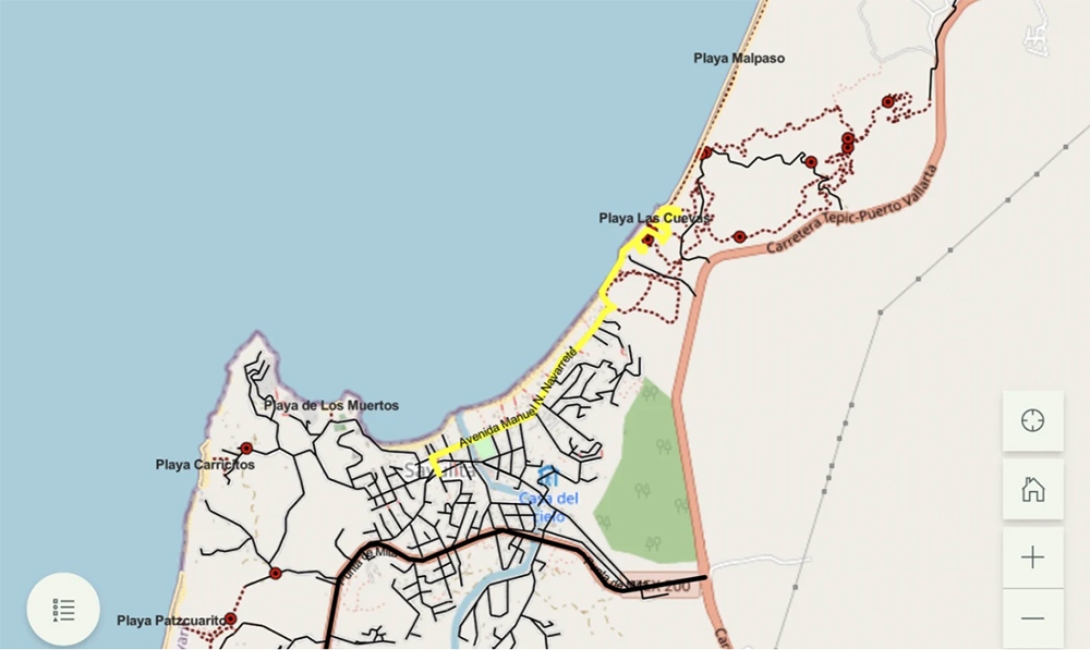
This local tourism story map for Sayulita, Mexico, shows the trails between town and outlying beaches of this charming beach town near Puerto Vallarta. Known for sunny skies, warm temperatures and abundant hiking opportunities, Sayulita was also the perfect candidate for custom local tourism maps. The trails are full of adventure and offer the opportunity to see birds and other wildlife as they cut through the jungle.
With cooperation from Sayulitalife.com, a local tourism site, we created local tourism story maps of jungle trails and routes to beaches to accompany the written descriptions on its web page. Now, the beauty of the area’s seaside, day hikes and jungle walks comes alive with photos, navigation aids and captions, which can be printed or accessed by mobile device – some even without internet or cell connectivity.
Read more: Sayulita Trails and Beaches: Day Hiking and Jungle Walks.
Learn more about Bell Geographic projects here.
Story Maps – When the Message Matters
Interactive story maps powerfully combine images, audio, written text and geographic data. They’re perfect for nontechnical audiences – no special knowledge is required to understand or access them. Easily shared and automated, story maps integrate into websites and social media, too.